
Upcoming intakes 1 classes open
- Starts 30/10/2026BIM Civil 3D ONOnline
Schedule 20h-22h thứ 2,4,6
Venue Online - Toàn Quốc
Tuition fee Students 3,050,000 VND·Engineers 3,600,000 VND·15 sessions
About this course
The Institute's 15-session Civil 3D course is built for infrastructure and road engineers who want to learn Civil 3D from survey data through to road design drawings and infrastructure BIM. Classes run live online over Zoom, with the instructor marking work in every session.
Autodesk Civil 3D is the core tool for infrastructure and highway engineers: it turns survey data into terrain surfaces, alignments, profiles, drainage networks and grading, with quantities updating automatically as the design changes. As BIM mandates for infrastructure tighten, these skills are a clear advantage.
This online course from the RDSIC training centre of the Institute of Information Technology in Civil Engineering — Hanoi University of Civil Engineering (HUCE) runs in two stages: ten sessions mastering Civil 3D from survey to deliverables, then five sessions on data management and BIM coordination covering BEP, the Common Data Environment and Navisworks, preparing students for both modelling and coordination roles.
Where to start with Civil 3D: the 15-session roadmap
The course follows the order in which a real road project is produced. Survey data comes first, because a terrain surface needs it. The surface comes next, because alignments and profiles are designed on it. The alignment comes before the corridor and the quantities. Learning Civil 3D in this order means each session reuses what the previous one produced.
| Sessions and topic | What you have at the end |
|---|---|
| Sessions 1–2: Survey data, the VN-2000 coordinate system, terrain surfaces | A terrain surface with contours for the corridor area |
| Sessions 3: Alignments and profiles | An alignment in plan, an existing-ground profile and a design profile |
| Sessions 4–5: Assemblies, corridors, junctions, daylight slopes, sample lines | A corridor model, cross sections and cut-and-fill volumes |
| Sessions 6–7: Gravity drainage networks | Pipes and manholes following the ground, with a BOQ table |
| Sessions 8–9: Feature lines and grading | A grading plan with balanced cut and fill |
| Sessions 10: Plan Production | Plan, profile and cross-section sheets produced in one batch |
| Sessions 11–15: BEP, CDE, LOD, Revit coordination, clash detection | A clash-checked multi-discipline model ready for handover |
The first ten sessions are about mastering the software. The last five are for those who will coordinate infrastructure models on BIM projects. To see how Civil 3D's dynamic model works before enrolling, read What is Civil 3D.
What do you need before learning Civil 3D?
The course does not teach the following from scratch, so students should already have:
- Basic AutoCAD: drawing, editing, layers, plotting. Civil 3D runs on AutoCAD, and students new to AutoCAD spend their effort on clicks instead of content. Without this foundation, take the AutoCAD course from beginner to advanced first.
- Road design knowledge at third-year highway or infrastructure student level: what profiles, cross sections, horizontal and vertical curves are. The course focuses on building them in Civil 3D.
- A computer that can run Civil 3D. No licence to buy: the Institute provides a time-limited educational licence to every learner, for learning use only; installation and minimum specs are in Install Civil 3D free for students.
- No Revit needed. Revit only appears in session 14, when surfaces and corridors are passed to other disciplines.
What you will learn
- Process survey point data, set up the VN-2000 coordinate system and manage large projects with Data Shortcuts.
- Build, refine and analyse terrain surfaces; design alignments and profiles to highway standards.
- Model corridors, resolve daylight slopes and junctions, and compute earthworks and pavement quantities.
- Design gravity drainage networks, run interference checks and export BOQ quantities.
- Grade sites with Feature Lines and Grading Objects, balancing cut and fill.
- Draft a BEP, run a CDE on Autodesk Forma and perform clash detection in Navisworks.
Who should enrol
- Road, infrastructure and water-resource engineers automating their design workflow.
- Engineers still drafting manually in 2D CAD who want to move to modelling.
- BIM Coordinators and Managers responsible for infrastructure scopes.
- Transport and urban infrastructure students preparing for employment.
Detailed syllabus
1. Project setup and survey data
- Optimising the Toolspace workspace
- VN-2000 coordinates and local unit conventions
- Importing, exporting and grouping survey points
- Sharing surfaces, alignments and networks across files with Data Shortcuts
2. Terrain surfaces and analysis
- Building surfaces from points, contours and text data
- Refining accuracy with breaklines and boundaries
- Slope, aspect and elevation analysis
3. Alignments and profiles
- Alignments with horizontal and transition curves to standard
- Design profiles and vertical curves
- Profile views, labels and data bands
4. Assemblies and corridors
- Building cross-sections from the subassembly library: carriageway, shoulders, footpaths, drains
- Corridor modelling with surface and width targets
5. Junctions, slopes and road quantities
- Corridor edits at junctions and curve widenings
- Complex cut and fill daylighting
- Sample lines and volume dashboards for earthworks and pavement
6. Drainage networks, basics
- Parts lists for gravity pipes and structures
- Laying out networks that follow existing ground
7. Advanced drainage and BOQ
- Hydraulic gradients on the profile
- Automatic pipe and manhole labels, interference checks
- Pipe length, manhole and trench excavation quantities
8. Grading with Feature Lines
- Creating and controlling characteristic elevation lines
- Fast, precise elevation editing commands
9. Grading objects and earthwork balance
- Graded areas, benching and slopes with Grading Objects
- Raising and lowering design surfaces to balance cut and fill
10. Drawing production
- Plan Production sheets: batch output of plans, profiles and cross-sections
11. Infrastructure BIM thinking and the BEP
- Benefits, challenges and Vietnamese regulations for infrastructure BIM
- Core BEP content for road and utility projects
- Naming, folder and layer conventions
12. The Common Data Environment
- Cloud data management principles
- Folders and role-based permissions on Autodesk Forma
- Review workflows, RFIs, issues and Autodesk Viewer
13. Multi-discipline models and LOD
- Splitting the federated model by discipline
- Base points and VN-2000 synchronisation across software
- LOD requirements for roads, drainage and landscape
14. Civil 3D to Revit coordination
- Bringing terrain and corridors into Revit with correct coordinates
- Converting pipe networks for high-LOD detailing of manholes, box culverts and overpasses
15. Quality control and clash detection
- Federating Civil 3D and Revit files in Navisworks or Forma
- Clash matrices and priorities
- Running detection, grouping issues and assigning them
- Coordination reports and final model review
Learning format
The course runs online over Zoom in 15 evening sessions with live instruction and homework review, plus support in the class group between sessions. Exercises follow the survey data and road documents of a real project.
Class photos and videos
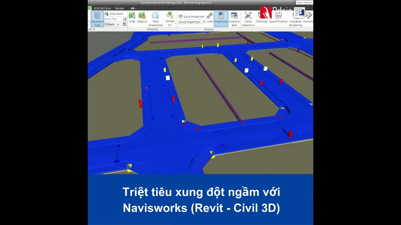

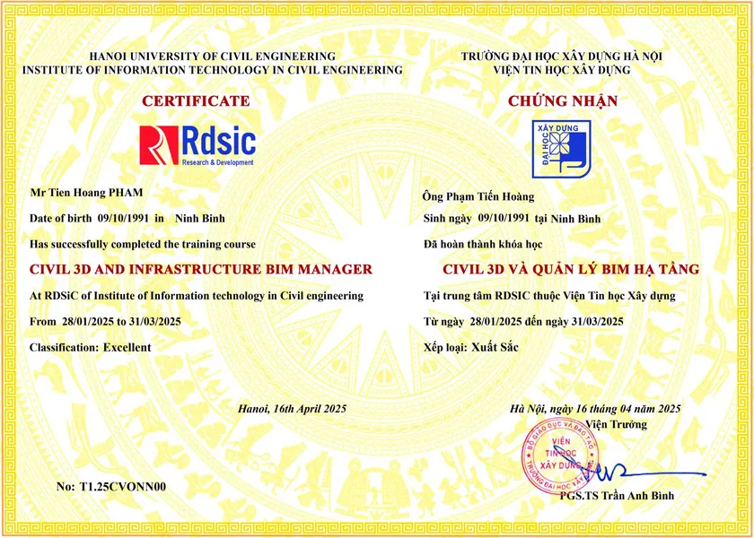



Certificate of completion
Graduates receive a certificate from the Institute of Information Technology in Civil Engineering — Hanoi University of Civil Engineering (HUCE). Call 0989 427 809 or 0914 388 841 for upcoming schedules.
Frequently asked questions
How much does the Civil 3D course cost?
Fees are shown in the class schedule at the top of the page, per class, with two rates: students and engineers. Click "Enrol in this class" on the class you want and the registration box shows that class's fee again before you send anything. Taking two or more courses earns the discount described in the promotion policy at the bottom of the page.
Is the Civil 3D course suited to road, bridge and infrastructure engineers?
Yes. The programme follows a real road dossier: VN-2000 survey data, terrain surfaces, alignments, profiles, corridor models, junctions, slopes and cut-and-fill quantities. The infrastructure part covers drainage networks, site grading with Feature Lines and earthwork balancing with Grading. For bridge works Civil 3D handles the alignment and terrain; box culverts, manholes and overpasses are detailed when the model moves to Revit in session 14.
Can I learn Civil 3D without knowing AutoCAD?
Yes, but it will be hard. Civil 3D uses every AutoCAD basic: drawing, selecting objects, layers, plotting. Civil 3D sessions do not stop to teach them. Newcomers to AutoCAD should take the AutoCAD course from beginner to advanced first.
Is learning Civil 3D online as effective as in person?
Yes, when the class has a lecturer teaching and correcting work live, as this course does. Classes run on Zoom in the evening, the lecturer guides and corrects work live in every session, and a class group answers questions afterwards. Online or in person? compares the two formats.
Do I need to buy an Autodesk Civil 3D licence to learn?
No. The Institute provides an Autodesk educational licence to every learner on the course, working engineers included. It is time-limited and for learning only: it may not be used for design work, commercial projects or any other non-educational purpose. Installation is covered in Install Civil 3D free.
Should I learn Civil 3D or Revit for infrastructure?
Choose by the shape of the work. Linear, terrain-following work such as roads, grading and drainage belongs in Civil 3D. Building-like structures such as control buildings or pumping stations belong in Revit. Large infrastructure projects need both, which is why session 14 covers passing surfaces and corridors to Revit. Infrastructure BIM vs building BIM explains the boundary.
Is there a certificate at the end of the Civil 3D course?
Yes. Students who complete the course receive a certificate from the Institute of Information Technology in Civil Engineering — Hanoi University of Civil Engineering. A sample is shown in the certificate section above.
Promotions and discounts
Group tuition discount — applied to every group member and the group leader:
| Group size | Group members | Group leader |
|---|---|---|
| 2 people | 5% off | 10% off |
| 3 people | 5% off | 15% off |
| 4 people | 5% off | 20% off |
| 5 people | 10% off | 25% off |
| 7 people | 10% off | 30% off |
| 10 people | 10% off | 50% off |
| 15 people | 10% off | 70% off |
| 20 people | 20% off | 100% off |
Note: this discount cannot be combined with any other promotion.
Discounts for taking multiple courses at RDSIC
- Take two courses in parallel and get 10% off the tuition of each course.
- Your second course at RDSIC is 10% off.
Deferral policy
- In-person courses: deferral of up to one year from the date the centre confirms it.
- Online courses: no deferral; as an exception, students who have attended less than 50% of the course may be granted a deferral of up to one year.
Related courses
- BIM Manager Course for Infrastructure
- Revit Architecture Course (BIM for Architects)
- Revit Structure Course (BIM for Structural Engineers)
- Revit MEP Course (BIM for M&E Engineers)
Browse the full list at Construction Courses.